So, this is the final post about Philadelphia...I promise. I just wanted to share a few more photos I took while we were visiting. Please bear with me as I try to curtail my love of urban history by only torturing you briefly with a bunch of details. Philadelphia, as many know (or don't know), was laid out by William Penn in 1682. Penn was granted the land that is now Pennsylvania, by King Charles II of England, and he set out to create a city on the Delaware River were anyone could live, regardless of their religion.
He also planned that the city's streets would be set up in a grid, with the idea that the city would be more like the rural towns of England than its crowded cities. The homes would be spread far apart and surrounded by gardens and orchards. The city would grant the first purchasers, the landowners who first bought land in the colony, land along the river for their homes. The city, which he named Philadelphia (philos, "love" or "friendship", and adelphos, "brother"), would have a commercial center for a market, state house, and other key buildings.
--Wikipedia
 |
| William Penn's Plan for Philadelphia, 1682 (From MIT Libraries) |
Penn sent three commissioners to supervise the settlement and to set aside 10,000 acres (40 km²) for the city. The commissioners bought land from Swedes at the settlement ofWicaco and from there began to lay out the city towards the north. The area went about a mile along the Delaware River between modern South and Vine Streets. Penn arrived in Philadelphia in October 1682. He felt the area was too cramped and expanded the city west to the bank of the Schuylkill River, making the city a total of 1,200 acres (4.8 km²). Streets were laid out in a gridiron system. Except for the two widest streets, High (now Market) and Broad, the streets were named after prominent landowners who owned adjacent lots. The streets were later renamed in 1684; the ones running east-west were renamed after local trees and the north-south streets were numbered. Within the area, four squares (now named Rittenhouse, Logan, Washington and Franklin) were set up as parks open for everyone. Penn designed a central square at the intersection of Broad and what is now Market Street that would be surrounded by public buildings.
--Wikipedia
I will stop with that because I could go on and on and on pointing out all kinds of interesting points in the history of Philadelphia that led it to where it is today....you've got the whole 18th century and Revolutionary War, our little friend Benjamin Franklin, etc. I'll leave you to your own devices with all of that. I trust you'll leave this post to immediately throw yourself into the depths of history. So from this point on, I'll just point out a few highlights of the cityscape I captured last week.
Philadelphia City Hall (statue of William Penn atop the tower), was completed in 1901 and remains the second tallest masonry structure in the world, as well as the largest municipal structure in the US.
 |
| City Hall is built on Centre Square, one of the original 5 squares in Penn's city plan,and the building design allows for pedestrians to pass through the building from one side of the square to the other. |
 |
| Subway station at City Hall. |
 |
| Art Deco Building on the east side of City Hall. |
The area around Rittenhouse Square has tons of great restaurants and shops.
 |
| I like the European-style sidewalk cafe seating (with chairs facing out) I kept coming across in the city. |
 |
| You could find these signs for pedestrians on every block. They show your current location in the city. |
 |
| Anthropologie's autumn decor. |
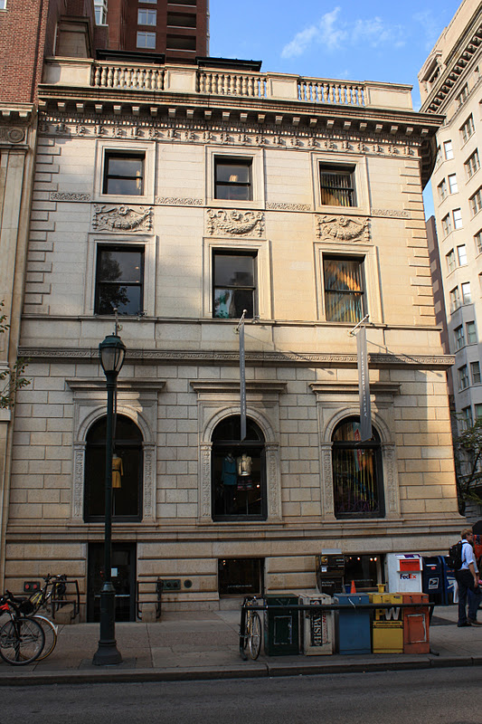
 |
| Anthropologie's flagship store at Rittenhouse Square. |
 |
| Pre-War Rittenhouse Plaza houses condos running from $500,000 to $3 million. |
 |
| Rittenhouse Square. |
And a few more photos a little further downtown, mostly along Walnut Street.
 |
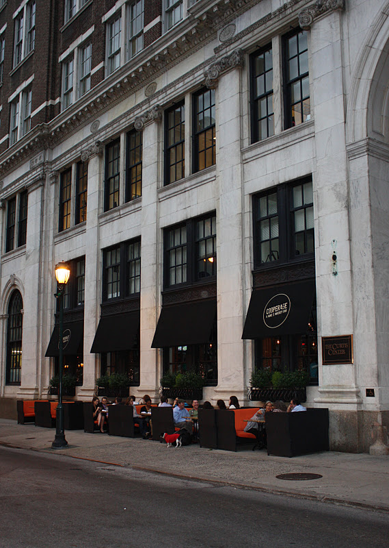
| I really wanted to eat here! |
a
 |
| Check out those booths on the sidewalk!!!! |


1 comment:
waooo..great architecture...!!!
Post a Comment